
Farewell comfortable bed, hot showers, clean clothes, and fresh meals. It's time for an adventure. It's time to really LIVE.
What will it take to get there? 1 mile walk, High Speed Rail, Subway, Light Rail 1, Light Rail 2, Car Ride, Flight, Van Ride, Ural Truck Ride, and (maybe) horses/more walking. And then we climb. Easy.
Next update from Kyrgyzstan.
Tuesday, 29 June 2010
Saturday, 26 June 2010
Expedition first aid kit
After speaking with a range of medically trained individuals and reviewing literature such as the UIAA's medical advice sheets (http://www.thebmc.co.uk/Feature.aspx?id=3158) we have compiled our expedition's first aid kit. As we are heading to a location that is particularly remote, we felt it was important to be as self-reliant as possible.
In assembling the kit, two critical questions were considered:
1.) What do we realistically need in the first aid kit? Yes, you could bring the Health and Safety Culture to the mountains, but that would probably involve choppering in a crate of paperwork and slow us down considerably.
2. What injuries and illnesses are we capable of dealing with? For example, there's no point bringing a suture kit if we lack the capabilities to stitch a wound when we have items like the hemostatic HemCon bandages and painkillers that will stabilise an injury sufficiently.
The list below is merely our own choice and it is only designed to be a point of reference. We have provided the UK names first and the US names second, a long with a short description of its purpose.
Matt
Medications (antibiotic)
Co-Amoxyclav aka Augmentin - chest infections, spreading skin infection, animal bites, UTI
Ciprofloxacilin aka Cipro - severe gastroenteritis
Flucloxacilin aka Clotrimazole - skin infection
Chloramphenicol Eye Drops - conjunctivitis/eye drops
Ciprofloxacin Eye Drops - eye infection, prophylactic
Otsporin - ear infection
Medications (pain)
IbuProfin aka Advil
Paracetamol / Acetaminophen aka Tylenol
Co-codamol/diclofenac Codeine aka Tylenol-3
Aspirin aka Bayer
Hydrocodone aka Vicodin
Medications (Altitude)
Acetazolomide aka Diamox - AMS
Nifedipene aka Adalat - HAPE
Dexamethasone - HACE
Medications (Gastrointestinal)
Loperamide aka Immodium - diarrhea
Simethicone aka Gas-X - gas, pressure, bloating
Bismuth Subsalicylate aka Pepto-Bismol - nausea, heartburn, indigestion, diarrhea
Medications (allergy)
Piriton aka Chlorophenamine - allergy relief
Diphenhydramine hydrochloride aka Benadryl - antihistamine
Medications (illness)
Cough Drops/Sweets
Oral Rehydration Salts
Cold Medicine
Tools
Small 'Paramedic' scissors -
Cotton wool sticks
Safety pins
Gloves
Electrical Tape
Duct Tape
Athletic Tape, 1.5" Zinc Oxide Tape
Thermometer, disposable
Scalpel
Tweezers
Sterile needle kit
Nail Clippers
Bandages
Tubi grip Ace bandage
Triangular bandage
HemCon Bandage
HemCon Bandage
HemCon Bandage
ChitoGauze
GuardaCare
HemCon Strip
Small Bandages
Medium Bandages
Guaze Pads
Crepe Bandage
Non-Adherent Dressing
Roll of Plaster
Severe Injury
Selection of elastoplast plasters
Quikclot
Sam Slpint
Steri Strips
Trauma Pad
Dental
Eugenol
Zinc Oxide powder
Clove oil
Small spare floss
Small spare tooth paste
Mini toothbrush
Cotton swabs
Orajel
Sanitation
Betadine Iodine
Saline Solution
Triple Antibiotic Ointment Neosporin
Antiseptic wipes
Alchohol wipes
Alchohol hand gel, large
Alchohol hand gel
Other
Insect Repellant, 100% DEET
Burn Ointment / Lidocaine
Cortisone Cream, 1%
Glutose Paste
Lubricating Eye Ointment ReNu Multiplus
Thursday, 24 June 2010
Tag Team
In a unfortunate twist, Steve has had to withdrawn from the team due to some unexpected circumstances. We certainly wish Steve the best as he has been an important part of getting this trip off the ground.
At this time, we'd like to announce that Daniel Clark will be the fourth team member. We've been working hard for the past week to work out all the details and go through all the proper channels with our sponsors. Daniel is about the only person who could jump onto a team two weeks before departure and not miss a beat. We're certainly glad to have him and he's primed to get after it. Dan was born in England and currently resides in Boston. He climbs with Mike and Chris on a regular basis. A short little bio is below:
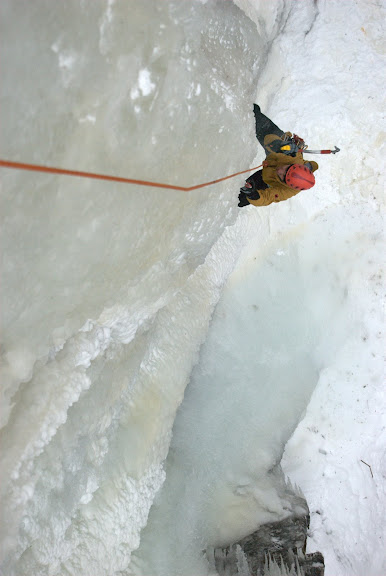 Dan at work in the Adirondacks.
Dan is always up for an adventure, no matter what kind. Born in England, Dan lived in several locations internationally before settling down in the United States. Exploring his surroundings wherever life took him, Dan set off on his first big adventure in 2004, at the age of 17. With partner Mike Royer, he traversed 400 miles of the Colorado Trail, the highest elevation trail in the United States, climbing several peaks along the way. After a few years exploring the northeastern United States, Dan escaped to Peru’s Cordillera Blanca in 2008 where he logged ascents of the northwest face of Yanapaccha, the northwest ridge of Tocllaraju, and the West ridge of Shaqsha. Back home, Dan enjoys training for his next big trip by climbing trad, sport, and ice. He hopes to continue honing his skills while seeking out adventure in the far corners of the world.
Goals
We have lots of goals for this trip, but clearly one of the most important is to climb some awesome new routes. With only sparse information about the range and a handful of photos, we are geared up for a lot of different scenarious. Rain, Snow; Hot, Cold; Rock, Ice; Choss, Granite; Known, Unknown. Included below are some of the interesting lines we've spotted in the photos we have. What's amazing is there is plenty more we've never seen and more options than we could possibly climb in a single trip.
Before you start drooling, take a minute to check out our latest sponsors: Justropes.com and HemCon Medical Technologies. JustRopes donated the team's ropes for the expedition, as well as a rope to the Alpine Fund. They're a great outfit run by climbers with a fabulous selection and good prices. HemCon donated a huge assortment of super awesome hemostatic (yeah, big word, Google it) bandages; good for soldiers, good for us.


Only a few days left at home! Time to savor favorite meals, comfortable beds, and hot showers.
Mike
Saturday, 19 June 2010
Following a Legacy
Style. We’re not reckless cowboys out for disaster, but climbing light, clean, and fast is important to us. We’re visiting a region that, as a whole, has seen only a handful of footprints, with most peaks never even seeing an attempt. We think it’s our duty and obligation to leave the place as pristine as we find it, as both ambassadors of our respective nations and as human beings. We aren’t style evangelists, but hope to lead by example.
The largest sponsor of our expedition is W.L. Gore and the Shipton-Tilman grant program. The program brief states: “Eric Shipton and Bill Tilman are arguably the greatest adventurers of this past century. They believed in traveling in small, compact teams, unburdened by porters and excessive bulk surviving on the bare minimum required to achieve their goal…Applications are accepted from small, unencumbered teams of friends with daring and imaginative goals. The expedition team must plan to accomplish their feat in a self-propelled, environmentally sound and cost-effective way.”
Shipton and Tilman changed the game when it came to exploration of the greater ranges. Using small teams, they managed to explore regions where larger expeditions had failed. From Africa to the Himalaya to Patagonia, Shipton and Tilman were not only climbers, but also explorers (Side note: I highly recommend the compilation of Shipton’s writings, The Six Mountain Travel Books). ‘Exploratory mountaineering’ is how I often describe our trip. As much as we seek to climb aesthetic, technical lines, we also hope to explore the potential of the region for future expeditions, making accessible our findings to inspire other climbers. We are not at the top of the list for technical skill, but we have a drive to get out there and do big things. We thank our sponsors for recognizing this and giving us the opportunity.
As a lightweight, low budget expedition, we won’t have ornate base camp palaces, lines of porters, computers, or helicopter rides. We plan to get as close as we can in a truck, then on horseback, then ferrying loads on our own backs. We’ll climb in teams of two for efficiency, aiming for fast alpine-style ascents. Our two-man teams are a form of redundancy, increasing our safety margin. We will leave as little gear behind as humanly possible, hopefully none.
In the end, we hope our expedition honors the legacy of Shipton and Tilman while inspiring other climbers to get out there and shoot for their dreams.
Mike
Friday, 18 June 2010
The Djangart
Unless you’re obsessed with our expedition (we’re cool with that) and spending hours researching (maybe you should get outside), you probably don’t know too much about the Djangart. Quite truthfully, we don’t either.
Hoping to put together an attractive grant application, we started looking for unclimbed peaks. I’m not sure who came up with Kyrgyzstan, but our imagination soon settled on an area known as the Western Kokshaal-Too. According to Garth Willis, “The Kokshaal-Too (“Forbidden Range”) is located on Kyrgyzstan’s Chinese border. It was a closed military region until the late 1990s, when the first Western expeditions visited the region. The Soviets had climbed the highest peaks, Dankova (5,982 meters) and Kizil Asker (5,842 meters), but the region as a whole had not been well explored by climbers. This will remain a region of unclimbed pearls for some years to come.” We dove in head first, looking through every American Alpine Journal from the past 15 years, compiling a database of all the expeditions, and crossing off peaks on the new map that exists for the area (Gamache/AAC). When we were done, we realized the Western Kokshaal-Too had become a popular destination rather than a mysterious anomaly.
Looking for something a bit more unexplored, we spotted a small note about the Djangart area on the webpage of the Kyrgyz Alpine Club. When we plugged it into Google, we didn’t come up with much. Nice. Initially, the only report we found of activity in the region was a trip by Tony Whitehouse and Graham Sutton. In 2004 they helicoptered in, intent on climbing Pt.5318, the highest in the region. Having no prior knowledge of the area, the big walls, pesky moraine fields, broken glaciers, and a limited timeframe thwarted their attempt. Subsequently, they’ve been very helpful in giving us an idea of what to expect.
Reading this report, we sent an email to some logistics providers in Kyrgyzstan to get a price on a helicopter. When we got the news that it would be roughly 5,000 EUR, we thought we were out of luck. Then Googling skill prevailed once again and we dug up a report from a 2008 Russian expedition led by Vadim Kodysh. For a long time, this 60 page translated-via-Google document was our best window into the Djangart. I remember spending days trying to make sense of the translation and plotting their course in Google Maps. While they climbed a few peaks, their main objective was to complete a circuit through the range. Not knowing of Whitehouse and Sutton, they thought the only other visitors had been a Russian expedition in 1932. The report was indispensible, as it helped us develop an alternate approach using an off-road vehicle and horses. Members from the Russian expedition had also geo-tagged a handful of photos that showed up in Google Earth. With those and Google Earth terrain, we picked out a few objectives.
Fastforward three months. Interested in getting more info and photos to help guide us, we decided to take a shot in the dark and send an email to the address listed on the report. A few hours later, we had opened a huge door. Vadim responded and after a lengthy exchange of emails, we had over 200 photos of the region (see earlier post). After some more tedious work to place the photos on a map using the written report, we finally had our first good glimpse of the range. We quickly learned that Google Earth was horribly inaccurate; whole mountains were missing. The Soviet-era maps we had procured weren’t too much better. Thinking about it now, without the set of photos we would have been going in blind.

So, about the Djangart. It’s part of the Kokshaal-Too ridge that forms the border between Kyrgyzstan and China. It is slightly lower in elevation than the Enylchek to the northeast or Western Kokshaal-Too to the southwest, but still boasts at least a dozen peaks over 5,000 m, all but one of which are unclimbed. The weather is notoriously unstable, with great fluctuations in temperature and long periods of precipitation. We’re mentally prepared to be tentbound for several days.
The glaciers are retreating rapidly making for some arduous approaches over broken moraines. Due to the moderate elevation, aspect plays a large role in route type: south faces appear to be almost entirely rock, while north faces offer snow, ice, and mixed options. The rock varies from crumbly shale to marble to granite, with the best granite seemingly located on the highest peaks along the border in the most eastern sector of the region.
Access is possible via the military border posts at Karasay and Uch-Koshkon, up the Kayche river valley and over the 4200 m Djangart pass. We are hopeful that a 6WD Ural truck can make it all the way to the Djangart valley, but know that the river crossings have been difficult for previous expeditions. Alternatively, it is possible to arrange horses with a local hunter in the Kayche valley.
In a phone conversation, Graham Sutton expressed the wild and untamed nature of the region. That’s exactly what we wanted to hear. While it’s not the Karakoram, we’ve spotted some aesthetic lines. We’re excited to carve out our own little corner of the globe.
Mike
Tuesday, 15 June 2010
Stairwells > Mountains
It's nearing midnight on Tuesday night. I push for one more lap up the hot, humid, sterile stairwell that leads up to my apartment. I feel the numbing burn kick in as I reach the 6th and final flight, but keep pushing knowing each step is one closer to...my front door. (Cue the cheesy music to the Discovery Channel Everest show.)
At least there were no strange looks from neighbors tonight.
In two weeks I'll be on a plane bound for Moscow and eventually Kyrgyzstan, but for now I'm stuck with the completely un-dramatic stairwell that I'm sure you were dying to hear about. In all seriousness, we're getting down to the nitty-gritty with equipment and logistics details. The bigger concern now is the political and social unrest that is destabilizing what was the most stable central Asian country when we started our planning.
Having read Over the Edge by Greg Child, I'm acutely aware of the possibilities for what can happen when visiting remote regions of this part of the world. It leaves nagging questions in my head, but for now that's all they'll remain. I can't count the number of news articles that have been forwarded to me over the last few days, but there were enough that I just started copying and pasting my response:
"Fortunately, Osh is in southern Kyrgyzstan and we will be in Bishkek (north) or climbing in the far northeastern part. We have definitely been monitoring the situation closely. I get regular updates from the US embassy and it seems like a good sign that Osh evacuees are being taken to Bishkek. A local source in Bishkek also says things are calm there. If there is even a small amount of concern regarding Bishkek we have the option to stay in a cabin in the mountains that are about 45-60 minutes from the city. If the violence spreads and we have major concerns, we'll have no choice but to cancel the trip. The makeup of the population in the south is different than in the north, so we are hopeful. Due to the borders drawn by Stalin, ethnic violence is nothing new in the south, but it had been calm until this spring. It is a bit ironic that we chose the most stable central Asian country and it has turned into the least stable."
Here's to hoping things all work out and in a few weeks we'll have something more interesting to report than running laps up a stairwell.
Mike
Tuesday, 1 June 2010
Updates All Around!
So much has happened in the last month it's hard to know where to begin. Planning has become a second job. It's not easy coordinating with people in four time zones spanning the entire globe and speaking two languages!
If you follow our Facebook page, you know that we've added the 5th and 6th members to the group who will be in the Djangart in July. Jamie Maddison, a freelance journalist and reporter for Climber magazine will be joining us to document our trials. We have also gotten confirmation that Abdybek, an Alpine Fund Intern, will be coming along to assist us in translating, hauling loads, cooking, and guarding our camp. We are extremely grateful to have both of them along.
The logisitics are coming together nicely thanks in no small part to Asel at ITMC Tien-Shan travel in Bishkek. We have been sorting through border permits, visas, transportation, equipment, flights, rescue insurance and more. Chris and I booked our flights last week, so we have our itinerary fixed. We'll depart on June 29 and return on August 5. I'm hoping that our visas are worked out without a hitch; after speaking to the Kyrgyz embassy over the phone, I'm not exactly reassured.
In more sponsorship news, I was awarded a Mountain Fellowship Award from the American Alpine Club and the REI Challenge Fund. Thank you for your support!
Possibly the biggest news of the month was getting in touch with Vadim Kodysh. Vadim was the leader of the 2008 Russian expedition that was the first to seriously explore the region. He has been exceptionally helpful in answering some of our questions, and has also supplied us with over 200 photos of the area. Looking through the photos was absolutely stunning and we are more excited than ever to get the trip under way. Dozens of beautiful 5,000 m unclimbed peaks are beckoning. More importantly, the photos are helping us to plan our trip in greater detail as we are working to refine objectives. As it turns out, Google Earth is horribly misleading. Whole peaks are just flattened and steep walls show up as gentle slopes. Thanks to the photos, we will be better prepared for our undertaking. A small photo teaser is included at the end of this post, but if you'd like to see more, check out the link in the Media section of our webpage. Again, we can't thank Vadim enough for the help.
Finally, I'd like to direct everyone to the open letter I am circulating seeking support for the Alpine Fund. The details are in the letter, but in short we are running a weekend climbing clinic for the kids the Alpine Fund serves. We have come to discover that they have no sleeping pads and a total of three quickdraws. So, we are working to fundraise so we can supply these basic items as well as cover the cost of the climbing clinic. Please, PLEASE, help us out and donate a few dollars (or maybe a pad or some draws). No amount is too small.


Less than one month to go...
Mike
Subscribe to:
Comments (Atom)


